
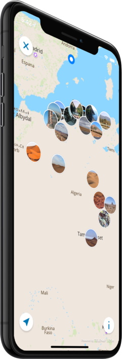
Offline map
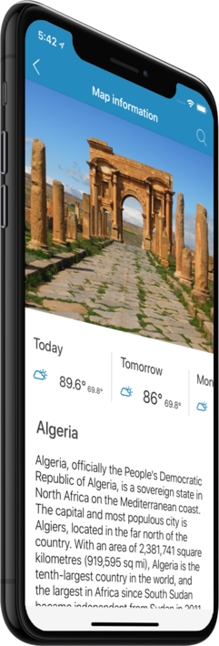
Algeria
Travel with a high-quality offline map featuring the most interesting sites, available on iPhone!
Country Days Tracker - this app track the days you spend in different countries helping you with visas and tax residency. Try it now!
Features
Turn your trip into an exciting and unforgettable experience
with the Algeria offline mobile map!
TOP DESTINATIONS
Our offline map offers you information about 29 top destinations, featuring high-quality descriptions, photos, and reviews written by real travelers.
HIGH-QUALITY CONTENT
Every location we feature comes with a description, a photo, and reviews written by real people.
SAVE ON MOBILE DATA!
All of the app’s features work offline! Simply download our completely autonomous map before your trip, and save mobile traffic!
FIND TOP DESTINATIONS NEARBY!
In addition to our featured locations, you will find tens of thousands of other useful places in our guide (hotels, restaurants, teller machines, public transport stops, points of interest, etc.)
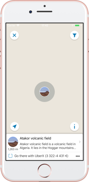
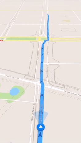
OFFLINE NAVIGATION
Plan the best driving, walking, or biking route offline! Save your locations, so you can always easily find your way back and never get lost.
WEATHER FORECAST AND CURRENCY CONVERSION!
Latest weather forecast and a handy conversion rate calculator for 200+ different currencies!
Top places of interest
Here is a list of just a few of the places of interest that you can find on our offline map.
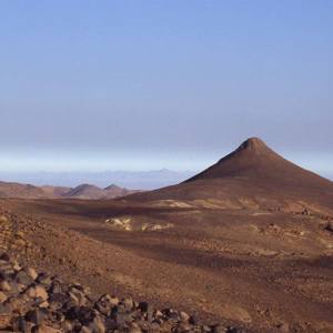
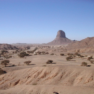
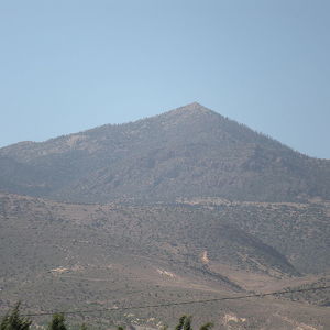
Atakor volcanic field
Atakor volcanic field is a volcanic field in Algeria. It lies in the Hoggar mountains and consists of a variety of volcanic features such as lava flows and about 450 individual vents which create a spectacular scenery. Atakor is one of several large...
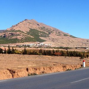
Aures
The Awras or Aures region is characterized both by its mountain terrain and by the Chaoui ethnic group that historically has inhabited the area. The rugged terrain of the Aurès made that the region became one of the less developed areas in the Maghreb....
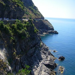
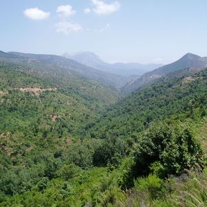
Corniche Jijelienne
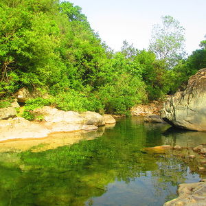
Corniche Jjilienne is a natural region of northern Algeria characterised by rocky forested massifs rising above the coastal plain.[1] The forested areas provide some of the last extant habitat for the endangered Barbary macaque, Macaca sylvanus; this p...
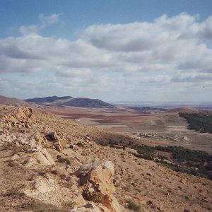
Hautes Plaines
The Hautes Plaines (High Plains), also known as Hauts Plateaux, is a steppe-like natural region located in the Atlas Mountains in northern Algeria. It stretches more than 600 km in an ENE - WSW direction from northeastern Morocco to the Aures. It is a ...
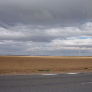
Hodna
The Hodna region has a length of about 120 km in an NW - SE direction and a width of about 80 km. It is characterized by the Chott El Hodna, an endorheic salt lake, in its centre with seasonal brackish and saline pools and marshes. A thin film of water...
Petite Kabylie
The Petite Kabylie is located in the mountainous area of the Bibans and the Babor Range, subranges of the Tell Atlas range bordering the Mediterranean. The Petite Kabylie is separated from the Grande Kabylie by the Soummam Valley. The Petite Kabylie...
West Saharan montane xeric woodlands
The West Saharan montane xeric woodlands is an ecoregion that extends across several highland regions in the Sahara. Surrounded at lower elevations by the largely barren Sahara, the West Saharan montane xeric woodlands are isolated refuges of plants an...
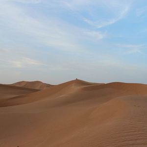
Erg Chebbi
The dunes of Erg Chebbi reach a height of up to 150 meters in places and altogether it spans an area of 50 kilometers from north to south and up to 5–10 kilometers from east to west lining the Algerian border. The nearest sizable town is Erfoud, abo...
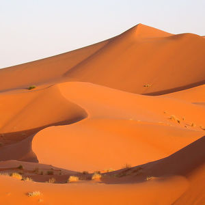
Grand Erg Occidental
The Grand Erg Occidental is the second largest erg in northern Algeria after the Grand Erg Oriental. It covers an area of approximately 78,000 square kilometres (30,000 sq mi).The sand dunes in the erg are formed by the wind, and can be up to 120 metre...
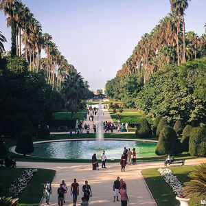
Botanical Garden Hamma
The Test Garden of Hamma is a 58-hectare (140-acre) botanical garden (38 hectares (94 acres) of gardens and 20 hectares (49 acres) of arboretum) located in the Mohamed Belouizdad (formerly Hamma-Anassers) district of Algiers. It was established in 1832.
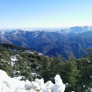
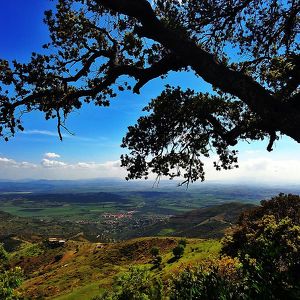
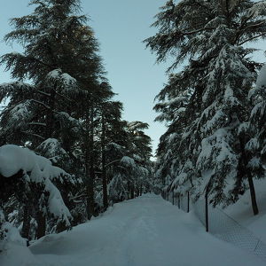
Chréa National Park
The Chréa National Park is one of the largest national parks of Algeria. It is located in Blida Province, named after Chréa, a town near this park. The park, located in a mountainous area known as the Blidean Atlas (which is part of the Tell Atlas) inc...
Belezma National Park
Created in 1984, it stretches over an area of 262.5 km², the climate ranges from a cool subhumid climate to a dry semi-arid climate, it contains 447 species of flora (14% of the national total) and 309 species of fauna, of which 59 are protected specie...
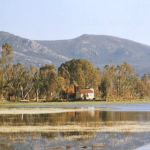
El Kala National Park
The national park of El Ka la is one of the national parks of Algeria, in the extreme north-east of the country. It is home to several lakes (including Lake Tonga, whose name is unrelated to Tonga) and a unique ecosystem in the Mediterranean basin, it ...
Djurdjura National Park
Nearby cities include Tizi Ouzou to the north and Bouïra to the south. The park is home to a very broken tectonics, as well as many forests, grottoes, gorges, and important fauna, including the endangered Barbary macaque, Macaca sylvanus, a primate who...
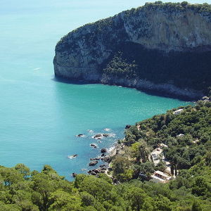
Gouraya National Park
The national park of Gouraya is one of the coastal national parks of Algeria. It is located in Béjaïa Province, near the shrine of Sidi Touati. The park is north-east of Béjaïa, close to the city. The park includes the 660 meter (2.165 feet) high mo...
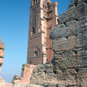
Tassili n'Ajjer
Tassili n'Ajjer is a national park in the Sahara desert, located on a vast plateau in south-east Algeria. Having one of the most important groupings of prehistoric cave art in the world, and covering an area of over 72,000 km2 (28,000 sq mi), Tassili n...
Taza National Park
The national park of Taza is one of the smaller national parks of Algeria. It is located in Jijel Province in the region of the Tell Atlas mountains, and is named after Taza, a town near this park. Its total area is 3,807 hectares (9,410 acres) and it ...
Théniet El Had National Park
The Théniet El Had National Park is one of the 10 national parks of Algeria. It is located in Tissemsilt Province, named after Théniet El Haâd, a town near this park.
Tlemcen National Park
The Tlemcen National Park is one of the more recent national parks of Algeria. It is located in Tlemcen Province, named after Tlemcen, a city near this park. The park includes the forests of Ifri, Zariffet, and Aïn Fezza, the waterfalls and cliffs of E...
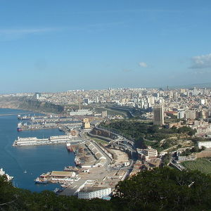
Port of Wahran
The Port of Wahran or Port of Oran is an Algerian port in the west of the country and exactly in the city of Oran, overlooking the Mediterranean Sea and is considered one of the important ports in each of the fields of trade and marine transportation.
Counter
29
TOP DESTINATIONS

6108
PLACES OF INTEREST

31453
HOTELS

17559
CAFES AND RESTAURANTS
Contact us
You can get in touch with us by filling out this form