
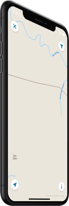
Offline map
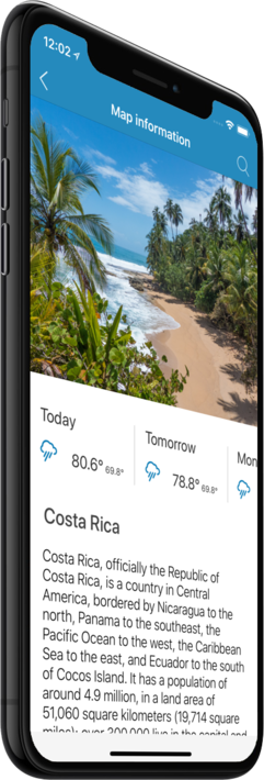
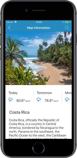
Costa Rica
Travel with a high-quality offline map featuring the most interesting sites, available on iPhone!
Country Days Tracker - this app track the days you spend in different countries helping you with visas and tax residency. Try it now!
Features
Turn your trip into an exciting and unforgettable experience
with the Costa Rica offline mobile map!
TOP DESTINATIONS
Our offline map offers you information about 24 top destinations, featuring high-quality descriptions, photos, and reviews written by real travelers.
HIGH-QUALITY CONTENT
Every location we feature comes with a description, a photo, and reviews written by real people.
SAVE ON MOBILE DATA!
All of the app’s features work offline! Simply download our completely autonomous map before your trip, and save mobile traffic!
FIND TOP DESTINATIONS NEARBY!
In addition to our featured locations, you will find tens of thousands of other useful places in our guide (hotels, restaurants, teller machines, public transport stops, points of interest, etc.)
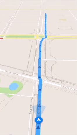
OFFLINE NAVIGATION
Plan the best driving, walking, or biking route offline! Save your locations, so you can always easily find your way back and never get lost.
WEATHER FORECAST AND CURRENCY CONVERSION!
Latest weather forecast and a handy conversion rate calculator for 200+ different currencies!

Top places of interest
Here is a list of just a few of the places of interest that you can find on our offline map.
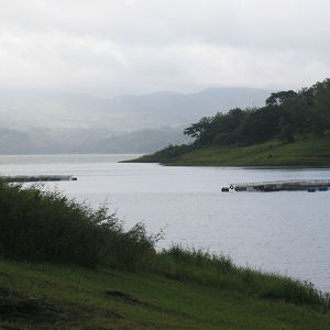
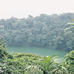

Lake Arenal
Lake Arenal was tripled in size with the construction of the Arenal dam in 1979, which exists at the eastern end of the lake. This hydroelectric project is hugely important to Costa Rica, initially generating 70% of the country's electricity, now close...
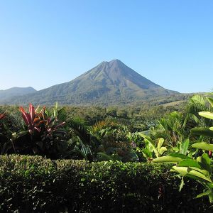
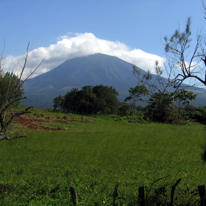
Arenal Volcano
Arenal Volcano is an active andesitic stratovolcano in north-western Costa Rica around 90 km northwest of San José, in the province of Alajuela, canton of San Carlos, and district of La Fortuna. The Arenal volcano measures at least 1,633 metres (5,358 ...
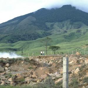
Miravalles Volcano
The Miravalles Volcano is an andesitic stratovolcano in Costa Rica. The caldera was formed during several major explosive eruptions that produced voluminous dacitic-rhyolitic pyroclastic flows between about 1.5 and 0.6 million years ago. The only repor...
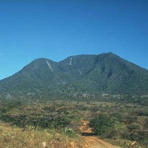
Orosí Volcano
The Orosí Volcano, in Spanish the Volcán Orosí, is an inactive volcano in Costa Rica, situated in the Cordillera de Guanacaste near the border with Nicaragua. The area around the volcano is a popular tourist destination, especially for more ecologicall...
Chato Volcano
It is possible to hike the Cerro Chato up to and inside the crater, but it is considered a difficult hike and only recommended for hikers of good physical condition. There are two possible routes, one beginning from near the La Fortuna Waterfall and on...
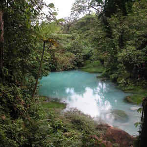
Tenorio Volcano National Park
Tenorio Volcano consists of four volcanic peaks and two craters. One of the craters is sometimes referred to as the Montezuma Volcano. Tenorio is 6,287 feet (1,913 m) high. The Rio Celeste (Light Blue River) appears blue due to the emission of sulphur ...
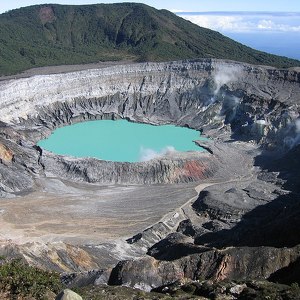
Poás Volcano
There are two crater lakes near the summit. The northern lake is known as the Laguna Caliente ("hot lagoon") and is located at a height of 2,300 m in a crater approximately 0.3 km wide and 30 m deep. It is one of the world's most acidic lakes. The acid...
Mount Chirripó
Mount Chirripó is the highest mountain in Costa Rica with an elevation of 3,820 meters (12,533 feet). It is located in Chirripó National Park and is noted for its ecological wealth. The mountain was named "Chirripo," meaning "land of eternal waters", b...
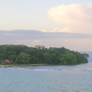
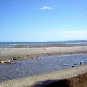
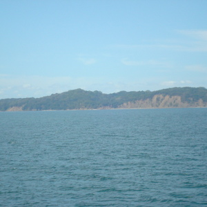
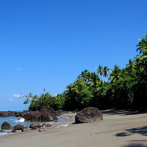
Uvita Island
Uvita has had several names over the years; in English, these include Grape Cay, Grape Island, and Uvia Island; in Spanish, the names Isla Uvita and La Uvita are now most common. The Cariari Indians called the island Quiribrí. In 1986 the Comisión Naci...
Burica Peninsula
This area is inhabited by people whose main activity is fishing. The Panamanian section is in Chiriquí Province, with the city of Puerto Armuelles, the most populous of the peninsula. Other localities include Guanábano, Las Mellizas, and Limones. On...
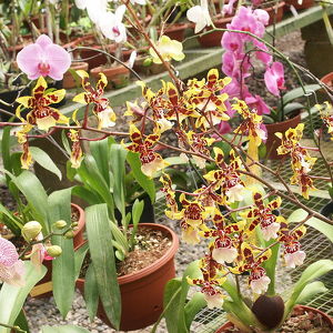
Lankester Botanical Garden
The Lankester Botanical Gardens (also known as the Jardín Botánico Lankester or Charles H. Lankester Botanical Garden) are a set of gardens outside of Cartago, Costa Rica. The garden is open to the public, but is operated by the University of Costa Ric...
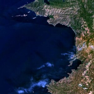
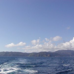
Gulf of Papagayo
The Gulf of Papagayo is a large body of water off Guanacaste province and the northwestern coast of Costa Rica. The Gulf and its coastline are part of a major tourism project by Costa Rica's government. One of the major resorts in the area is the Alleg...
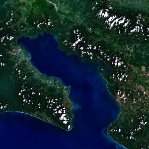
Golfo Dulce
In the northeast part of the gulf is the Piedras Blancas National Park (former Corcovado National Park extension), with its 14,000 hectares (35,000 acres) of protected rainforest. The tropical lowland wet forest is one of the most threatened and least ...
San Lucas Island
From 1873 to 1991, San Lucas Island was a penal island for some of the worst criminals in Costa Rica. It is often erroneously cited as the largest prison in Costa Rican history. It was founded by the dictator Tomás Miguel Guardia Gutiérrez. Being sent ...
Guanacaste Conservation Area
Across this large area, four of the five major tropical ecosystems are found: marine/coastal, dry forest, rainforest, and cloud forest. Desert is the only ecosystem type not represented. This protected area contains the largest amount of dry forest fro...
Cocos Island
Cocos Island was declared a Costa Rican National Park by means of Executive Decree in 1978. Cocos Island National Park was designated a World Heritage Site by UNESCO in 1997. In 2002, the World Heritage Site designation was extended to include an expan...
La Amistad International Park
The park area is equally split between Costa Rica and Panama, as part of the former La Amistad Reserves of the Talamanca mountain range. It covers 401,000 ha of tropical forest and is the largest nature reserve in Central America; together with a 15 km...
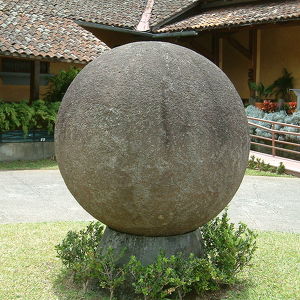
Stone spheres of Costa Rica
The archaeological site of Palmar Sur is located in the southern portion of Costa Rica, known as the Diquís Delta, and in the southernmost part of the Puntarenas Province. The Diquís Delta is defined as the alluvial plain with the geographical boundari...
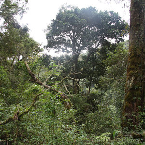
Corcovado National Park
The park conserves the largest primary forest on the American Pacific coastline and one of the few remaining sizable areas of lowland tropical forests in the world. Historically, logging has taken place in lowland areas because those areas are more eas...
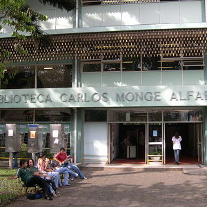
University of Costa Rica
The first institution dedicated to higher education in Costa Rica was the University of Saint Thomas (Universidad de Santo Tomás), which was established in 1843. That institution maintained close ties with the Roman Catholic Church and was closed in 18...
Counter
24
TOP DESTINATIONS

581
PLACES OF INTEREST

5929
HOTELS

5125
CAFES AND RESTAURANTS
Contact us
You can get in touch with us by filling out this form