
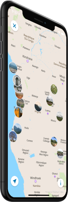
Offline map
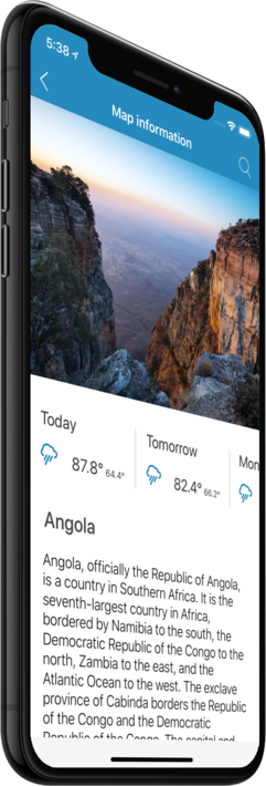
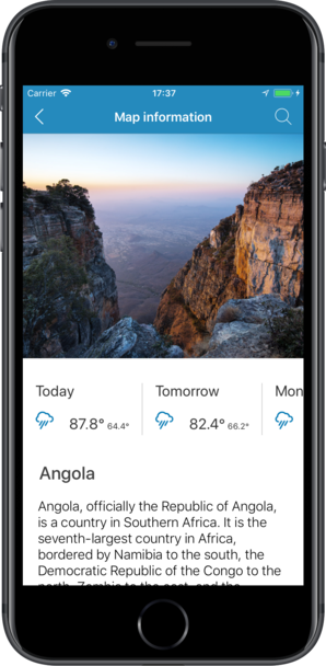
Angola
Travel with a high-quality offline map featuring the most interesting sites, available on iPhone!
Country Days Tracker - this app track the days you spend in different countries helping you with visas and tax residency. Try it now!
Features
Turn your trip into an exciting and unforgettable experience
with the Angola offline mobile map!
TOP DESTINATIONS
Our offline map offers you information about 26 top destinations, featuring high-quality descriptions, photos, and reviews written by real travelers.
HIGH-QUALITY CONTENT
Every location we feature comes with a description, a photo, and reviews written by real people.
SAVE ON MOBILE DATA!
All of the app’s features work offline! Simply download our completely autonomous map before your trip, and save mobile traffic!
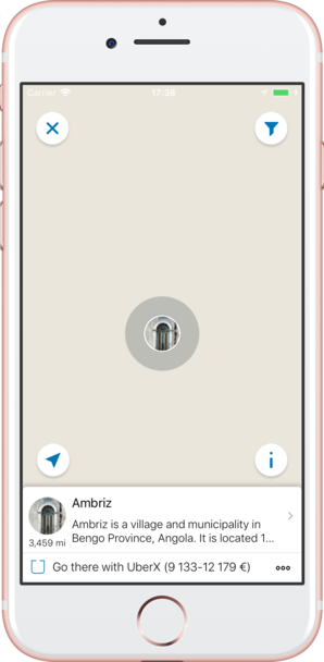
FIND TOP DESTINATIONS NEARBY!
In addition to our featured locations, you will find tens of thousands of other useful places in our guide (hotels, restaurants, teller machines, public transport stops, points of interest, etc.)
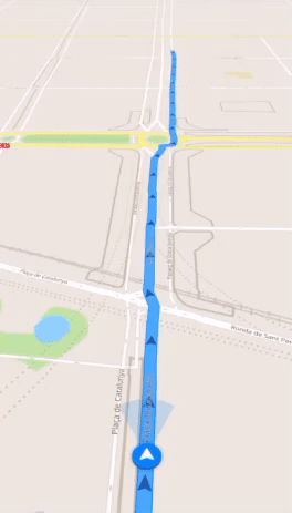
OFFLINE NAVIGATION
Plan the best driving, walking, or biking route offline! Save your locations, so you can always easily find your way back and never get lost.
WEATHER FORECAST AND CURRENCY CONVERSION!
Latest weather forecast and a handy conversion rate calculator for 200+ different currencies!
Top places of interest
Here is a list of just a few of the places of interest that you can find on our offline map.

Ambriz
Ambriz is a village and municipality in Bengo Province, Angola. It is located 127Km from the town of Caxito. It borders the municipality of N'zeto, Zaire Province, to the North and the municipality of Dande, to the South. The population of Ambriz to...
Luanda
Luanda, formerly named São Paulo da Assunção de Loanda, is the capital and largest city in Angola, and the country's most populous and important city, primary port and major industrial, cultural and urban centre. Located on Angola's coast with the Atla...
Benguela
Benguela is a city in western Angola, south of Luanda, and capital of Benguela Province. It lies on a bay of the same name, in 12° 33’ S., 13° 25’ E. Benguela is one of Angola's most populous cities.
Iona National Park
Iona National Park (Portuguese: Parque Nacional do Iona) is the largest national park in Angola. It is situated in the Southwestern-most part of the country, in Namibe Province. It is roughly bounded by the Atlantic Ocean to the West, an escarpment to ...
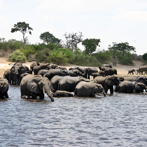
Kavango–Zambezi Transfrontier Conservation Area
Kavango–Zambezi Transfrontier Conservation Area (KAZA) is situated in a region where the international borders of five countries converge. It includes a major part of the Upper Zambezi basin and the Okavango basin and Delta. The zone includes the Capri...
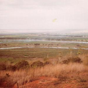
Quiçama National Park
Quiçama National Park, also known as Kissama National Park, is a national park in northwestern Angola. It is the only functioning national park in all of Angola, with the others being in disrepair due to the Angolan Civil War. The park is approxi...
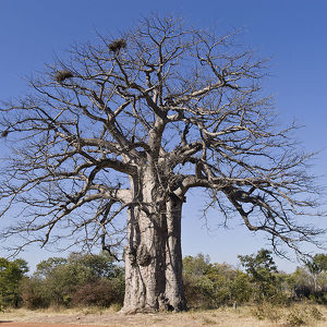
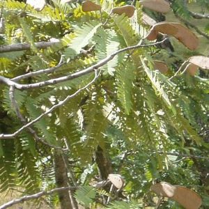
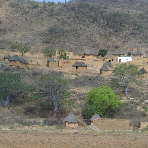
Central Zambezian miombo woodlands
The densely forested Central Zambezian miombo woodlands that cut across southern central Africa are one of the largest ecozones on the continent and home to a great variety of wildlife, including many large mammals.
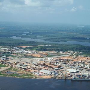
Kwanda Island
Kwanda Island is an island located near Soyo, Angola at the mouth of the Congo River. The island's main purpose is to support oil and gas projects for the country of Angola. Several LNG projects have begun on the island. Kwanda, Lda. is the operator...
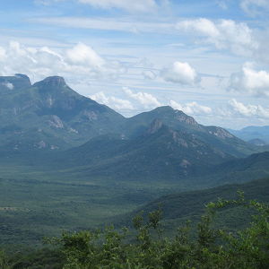
Serra da Leba
Serra da Leba is a mountain range in the province of Huíla, in Angola. Located near the city of Lubango, Serra da Leba is famous for its altitude, for its beauty and also for the Serra da Leba pass.
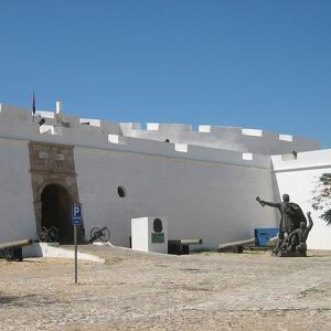
Fortress of São Miguel
Fortaleza de São Miguel or Saint Michael Fortress was a Portuguese fortress built in Luanda, Angola. São Miguel fort was built in 1576 by Paulo Dias de Novais. It became the administrative center of the colony in 1627 and was a major outlet for slav...
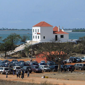
Museum of the Armed Forces
The Museum of the Armed Forces is located in Fortaleza de São Miguel de Luanda, in Luanda, Angola. Founded in 1975, following the independence of Angola, the museum includes bi-motor airplanes, combat vehicles, and diverse arms and artifacts used du...
National Museum of Slavery
The National Museum of Slavery (Portuguese: Museu Nacional da Escravatura) is located in Morro da Cruz, Luanda, Angola. The museum was founded in 1977 by the National Institute of Cultural Patrimony, with the objective of depicting the history of sl...
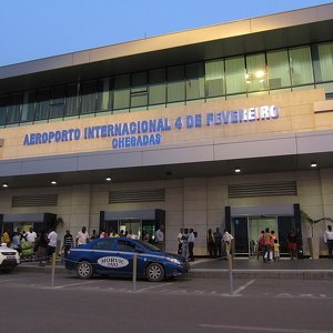
Quatro de Fevereiro Airport
Quatro de Fevereiro International Airport (Portuguese: Aeroporto Internacional 4 de Fevereiro), (IATA: LAD, ICAO: FNLU) is the main international airport of Angola. It is located in the southern part of the capital Luanda, situated in the Luanda Provin...
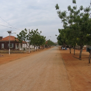
Barra do Dande
Barra do Dande is a town and commune in the municipality of Dande, province of Bengo, Angola. It is located at the mouth of the Dande River. The government plans to build a deep-water port at Barra do Dande. This new port is about 30 km north of Luanda.
Sumbe
Sumbe is a city located in west central Angola. It is the administrative capital of Cuanza Sul Province. Its population counts about 26,000. The city has a dry tropical climate. The hottest temperatures are from January to April, and the coldest months...
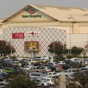
Belas Shopping
Belas Shopping is the first modern shopping center of Angola, located in the Talatona area of Luanda. Covering an area of almost 120,000 square meters, with a budgeted investment initially of 35 million dollars, it was built by Angolan subsidiary Odebr...
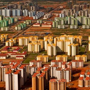
Kilamba
Nova Cidade de Kilamba (Kilamba New City) is a large housing development 30 km (18 miles) from Luanda, the capital city of Angola. It is being built by the China International Trust and Investment Corporation. Kilamba covers an area of 8.8 square ki...
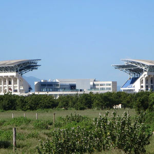
Estádio Nacional de Ombaka
Ombaka National Stadium is a multi-use stadium in Benguela, Angola. Completed in 2010, it is used mostly for football matches and has hosted some events for the 2010 African Cup of Nations. The stadium has a capacity of 35,000 people.
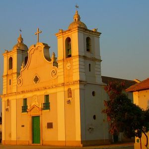
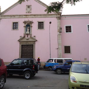
Nossa Senhora da Nazaré
The church was built in 1664 by Governor André Vidal de Negreiros (1606–1680) in gratitude to the Virgin Mary for safeguarding his ship during a storm which occurred while he was travelling to Angola. A plaque on the wall, however, indicates it was in ...
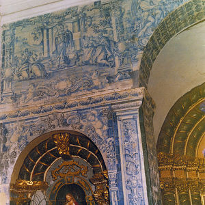
Nossa Senhora do Carmo
Igreja e Convento de Nossa Senhora do Carmo (Church and Convent of Our Lady of Mount Carmel), also Igreja do Carmo, is a church and convent complex in Luanda, Angola. Thanks to its good condition, the church is considered to be one of the country's mos...
Counter
26
TOP DESTINATIONS

234
PLACES OF INTEREST

226
HOTELS

1005
CAFES AND RESTAURANTS
Contact us
You can get in touch with us by filling out this form