
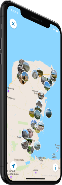
Offline map
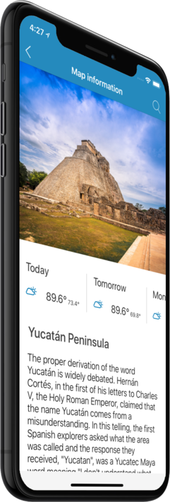
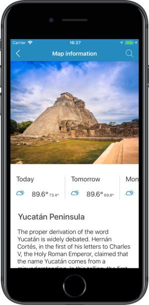
Yucatán Peninsula
Travel with a high-quality offline map featuring the most interesting sites, available on iPhone!
Country Days Tracker - this app track the days you spend in different countries helping you with visas and tax residency. Try it now!
Features
Turn your trip into an exciting and unforgettable experience
with the Yucatán Peninsula offline mobile map!
TOP DESTINATIONS
Our offline map offers you information about 55 top destinations, featuring high-quality descriptions, photos, and reviews written by real travelers.
HIGH-QUALITY CONTENT
Every location we feature comes with a description, a photo, and reviews written by real people.
SAVE ON MOBILE DATA!
All of the app’s features work offline! Simply download our completely autonomous map before your trip, and save mobile traffic!
FIND TOP DESTINATIONS NEARBY!
In addition to our featured locations, you will find tens of thousands of other useful places in our guide (hotels, restaurants, teller machines, public transport stops, points of interest, etc.)
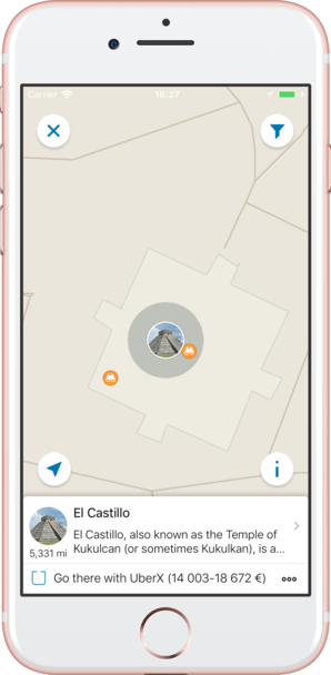
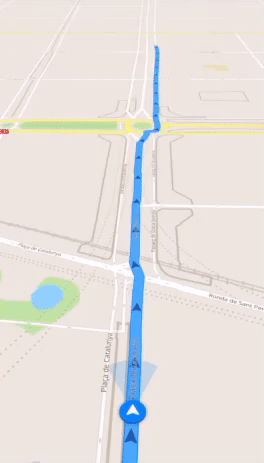
OFFLINE NAVIGATION
Plan the best driving, walking, or biking route offline! Save your locations, so you can always easily find your way back and never get lost.
WEATHER FORECAST AND CURRENCY CONVERSION!
Latest weather forecast and a handy conversion rate calculator for 200+ different currencies!
Top places of interest
Here is a list of just a few of the places of interest that you can find on our offline map.
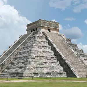
El Castillo
El Castillo, also known as the Temple of Kukulcan (or sometimes Kukulkan), is a Mesoamerican step-pyramid that dominates the center of the Chichen Itza archaeological site in the Mexican state of Yucatán. The building is more formally designated by arc...
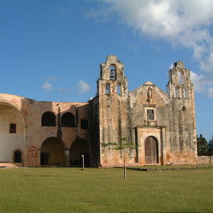
Maní
Maní's four millennium existence historically involves mostly its early Maya period, followed in recent centuries by its Spanish conquistador and religious period. Its Mexican period beginning over a century ago involved conflict.
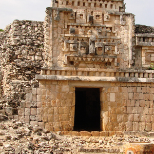
Xlapak
Xlapak (or Xlapac) is a small Maya archaeological site in the Yucatan Peninsula of southeastern Mexico. It is located in the heart of the Puuc region, about 4 kilometres (2.5 mi) from the archaeological site of Labná and a similar distance from Sayil, ...
Caye Caulker Airport
Caye Caulker Airport (IATA: CUK) is an airport that serves Caye Caulker, Belize. The runway is asphalt. The runway is closed and unusable until further notice.
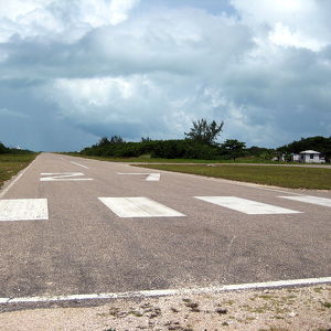
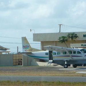
Placencia Airport
Placencia Airport (IATA: PLJ) is an airport that serves Placencia, Belize. It has a paved strip and crosses the peninsula from East to West.[3] As of December 2012, the runway is paved in good condition. There are short obstacles at either end of th...
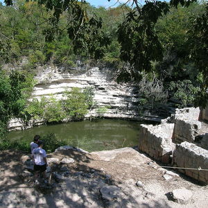
Sacred Cenote
The Sacred Cenote refers to a noted cenote at the pre-Columbian Maya archaeological site of Chichen Itza, in the northern Yucatán Peninsula. It is located to the north of Chichen Itza's civic precinct, to which it is connected by a 300-metre (980 ft) s...
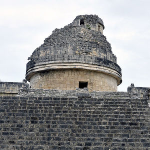
El Caracol
The structure is dated to around AD 906, the Late Classic period of Mesoamerican chronology, by the stele on not Upper Platform. It is suggested that the El Caracol was an ancient Mayan observatory building and provided a way for the Mayan people to...
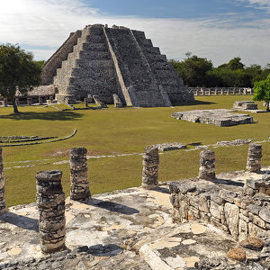
Mayapan
Mayapan (Màayapáan in Modern Maya), (in Spanish Mayapán) is a Pre-Columbian Maya site a couple of kilometers south of the town of Telchaquillo in Municipality of Tecoh, approximately 40 km south-east of Mérida and 100 km west of Chichen Itza; in the st...
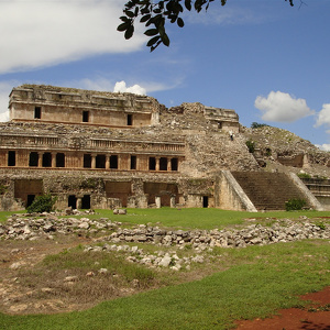
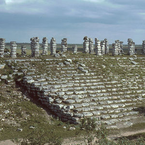
Sayil
Sayil is a Maya archaeological site in the Mexican state of Yucatán, in the southwest of the state, south of Uxmal. It was incorporated together with Uxmal as a UNESCO World Heritage Site in 1996. Sayil flourished principally, albeit briefly, during...
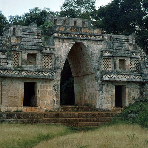
Labna
Labna is a Mesoamerican archaeological site and ceremonial center of the pre-Columbian Maya civilization, located in the Puuc Hills region of the Yucatán Peninsula. It is situated to the south of the large Maya site of Uxmal, in the southwest of the pr...
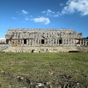
Kabah (Maya site)
Kabah is a Maya archaeological site in the Puuc region of western Yucatan, south of Mérida. The site is on Fed 261, approximately 140 kilometres (87 miles) south from Mérida, Yucatán, towards Campeche, Campeche, and is a popular tourism destination....
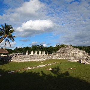
El Rey archaeological site
The El Rey site is located on the Mexican coast of the Caribbean Sea, in the hotel zone of the island of Cancun. The island is located on the outskirts of the city centre and is connected by two bridges to the mainland. The original name in the Maya...
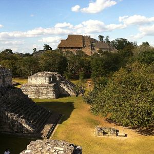
Ek' Balam
Ek' Balam is a Yucatec-Maya archaeological site within the municipality of Temozón, Yucatán, Mexico. It lies in the Northern Maya lowlands, 25 kilometres (16 mi) north of Valladolid and 56 kilometres (35 mi) northeast of Chichen Itza. From the Preclass...
Ake
Ake (or Aké in Spanish orthography) is an archaeological site of the pre-Columbian Maya civilization. It’s located in the municipality of Tixkokob, in the Mexican state of Yucatán; 40 km (25 mi) east of Mérida, Yucatán. The name Ake is a toponym tha...
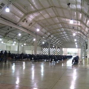
Yucatán Siglo XXI Convention Centre
Yucatán Siglo XXI (Spanish for "21st century") is a convention centre located in northern Mérida, Yucatán, Mexico. Halls in Siglo XXI have names referring to Maya heritage sites in the region such as "Salón Chichén Itzá", "Salón Uxmal", and "Salón Ek B...
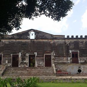
Yaxcopoil
Hacienda Yaxcopoil (YASH-coh-poh-EEL) is a town and hacienda located near Merida Mexico, in the Umán Municipality, Yucatán. Hacienda Yaxcopoil dates back to the 17th century, the name Yaxcopoil means "the place of the green alamo trees" in the Yucatec ...
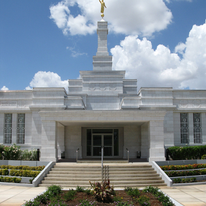
Mérida Mexico Temple
The Mérida Mexico Temple is the 92nd operating temple of The Church of Jesus Christ of Latter-day Saints (LDS Church). The building of the temple in Mérida, Yucatán, was announced on September 25, 1998. It is one of thirteen temples in Mexico. A ...
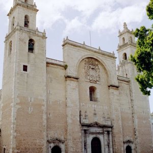
Cathedral of Mérida
The cathedral was built on the site of Mayan ruins Tiho. The cathedral of Mérida, seat of the bishopric of Yucatán, was the first cathedral to be finished on the American mainland, and the only one (with the exception of Santo Domingo de Guzman on t...
Universidad Autónoma de Yucatán
The Universidad Autónoma de Yucatán (Autonomous University of Yucatan), or UADY, is an autonomous public university in the state of Yucatán, Mexico, with its central campuses located in the state capital of Mérida. It is the largest tertiary educationa...
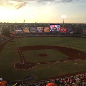
Parque Kukulcán Alamo
Parque Kukulcán Alamo (Kukulcán Alamo Park) is a stadium located in the city of Mérida, Yucatán, Mexico. It is primarily used for baseball, and is the home field of the Leones de Yucatán (Yucatán Lions) Mexican League baseball team. It holds 14,917 peo...
Counter
55
TOP DESTINATIONS

824
PLACES OF INTEREST

7292
HOTELS

1747
CAFES AND RESTAURANTS
Contact us
You can get in touch with us by filling out this form