
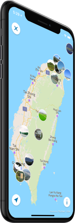

Offline map
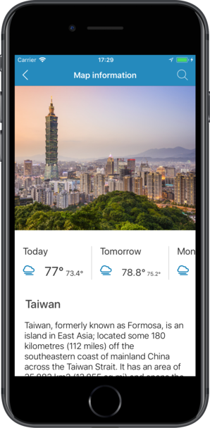
Taiwan
Travel with a high-quality offline map featuring the most interesting sites, available on iPhone!
Country Days Tracker - this app track the days you spend in different countries helping you with visas and tax residency. Try it now!
Features
Turn your trip into an exciting and unforgettable experience
with the Taiwan offline mobile map!
TOP DESTINATIONS
Our offline map offers you information about 30 top destinations, featuring high-quality descriptions, photos, and reviews written by real travelers.
HIGH-QUALITY CONTENT
Every location we feature comes with a description, a photo, and reviews written by real people.
SAVE ON MOBILE DATA!
All of the app’s features work offline! Simply download our completely autonomous map before your trip, and save mobile traffic!
FIND TOP DESTINATIONS NEARBY!
In addition to our featured locations, you will find tens of thousands of other useful places in our guide (hotels, restaurants, teller machines, public transport stops, points of interest, etc.)
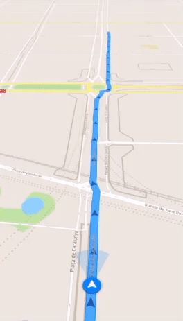
OFFLINE NAVIGATION
Plan the best driving, walking, or biking route offline! Save your locations, so you can always easily find your way back and never get lost.
WEATHER FORECAST AND CURRENCY CONVERSION!
Latest weather forecast and a handy conversion rate calculator for 200+ different currencies!

Top places of interest
Here is a list of just a few of the places of interest that you can find on our offline map.

Chianan Plain
The Chianan Plain or Jianan Plain is an alluvial plain located at the central-southern region of western Taiwan. It is the largest plain of the island, and lies in Tainan City and Chiayi County/Chiayi City, from which the name of the plain derived. It ...
Lantan Lake
The lake is also called the Holland Lake, Dutch Lake, and Hong-Mao Pei (see ang mo) because the lake was dug by the Dutch around 300 years ago during the Dutch Formosa rule by taking it source from the Bazhang River to irrigate the broad fields run by ...
Dongsha Atoll National Park
The Dongsha Atoll National Park is the seventh national park of the Republic of China (Taiwan), managed by the Ministry of the Interior. It was established on 17 January 2007; and on 4 October of the same year a preparatory administrative office was se...
Fengbitou Archaeological Site
The site was discovered by Japanese scholar Sueo Kaneko around 1941. In 1945, Japanese archaeologist Kiyotari Tsuboi excavated the site and presented his findings at an international conference in 1953. In 1965, Taiwanese archaeologist Jhang Guang-jhi ...
Guomao Community
The Guomao Community in its present form originated from a military dependents' village which was originally built in the 1960s and which was then the largest such village in Taiwan. The residents of Guomao Community were subsequently relocated from sa...
Hamaxing
The name Hamaxing was derived from Japanese "Hamasen ", meaning "beach railway line", this being the Japanese name of two railways which passed through this area. It used to be the hub for railway and ocean cargo. It was the center of politics, economy...
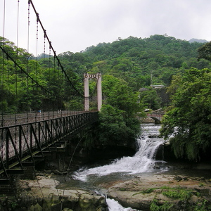
Maolin National Scenic Area
The scenic area is located at the western side of Central Mountain Range foothill which covers three rivers. It is located within the boundary of Sandimen Township of Pingtung County and Maolin and Liugui Districts of Kaohsiung City. The average temper...
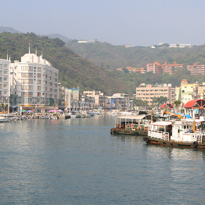
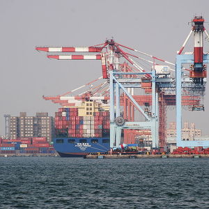
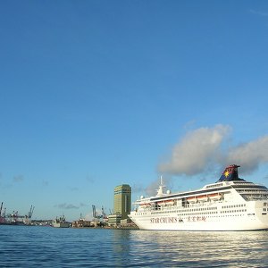
Port of Kaohsiung
The port was a natural lagoon before eventually developed through into a modern harbor over the period of several hundred years. At the time of 16th century, some villages had already established on the seashore of the present-day Kaohsiung, which was ...
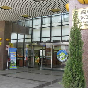
Yushan National Park
Yushan National Park is one of the nine national parks in Taiwan and was named after the summit Yushan, the highest peak of the park. The park covers a total of 103,121 hectares including large sections of the Central Mountain Range. The park contains ...
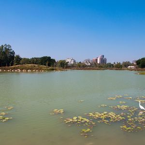
Banping Lake Wetland Park
The area around the park used to be a geological limestone mountain called Mount Banping. It used to be an important source of Taiwan's limestone ore needs. In 1997, the mining activities ceased to operate after 30 years of activity and the mining area...
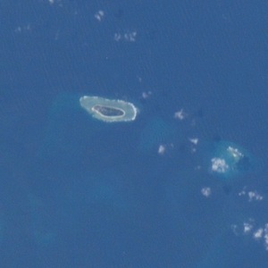
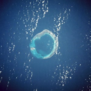
Zhongzhou Reef
Zhongzhou Reef also known as Ban Than Reef and Centre Cay is a small coral reef on the north edge of the Tizard Bank in the Spratly Islands, South China Sea. It lies 4.6 km (2.9 mi) east of ROC-occupied Taiping Island (Itu Aba), 7.2 km (4.5 mi) west of...
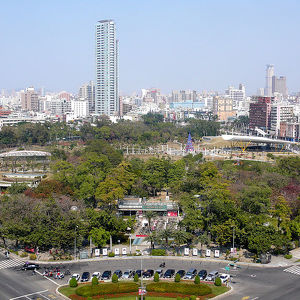
Central Park (Kaohsiung)
City planners first conceived of, and set aside space for, a park at Central Park's current location during the period when Taiwan was under Japanese rule. Later on, planners during the early period of Republic of China rule referred to the concept as ...
Weiwuying Metropolitan Park
During the Qing Dynasty rule of Taiwan, Fongshan was an important military area. During the Japanese rule, the Japanese viewed Kaohsiung as a base to develop the southern region of Taiwan and started to deploy armies and set up warehouses there called ...
Pratas Islands
Pratas Island is the only area above sea level. It has an area of about 240 hectares (590 acres), including 64 hectares (160 acres) of lagoon, and is the largest of the South China Sea Islands. It is the location of the Dongsha Airport. The Pratas a...
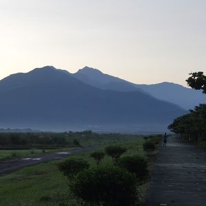
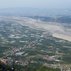
Pingtung Plain
Pingtung Plain is a plain area including parts of Pingtung County and Kaohsiung City in Taiwan. It includes the alluvial fan of Kaoping River, which forms the largest drainage area of rivers in Taiwan, and also passed by other shorter rivers such as Tu...
Port of Keelung
The 1858 Treaty of Tientsin specified Tamsui as an open port. The Port of Keelung opened few years later in 1886. In the Japanese colonial period, the Governor-General of Taiwan started the development of Keelung Harbor. By the early and middle 20th ce...
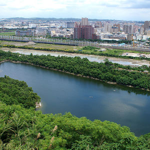
Keelung River
The Keelung River originates in the mountains west-northwest of the town of Jingtong in Pingxi District, New Taipei City, flows down to a rift valley and then flows ENE to Sandiaoling. Then it flows northward to a point between Chiufen and Keelung City...
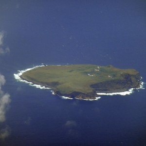
Pengjia Islet
Pengjia Islet, also known as Agincourt, Dashihshan Islet, Chaolai Islet or Pengchia Islet, is an islet north of Taiwan and is administered under Zhongzheng District, Keelung City. It is under Taiwanese military control and cannot be visited by ordinary...
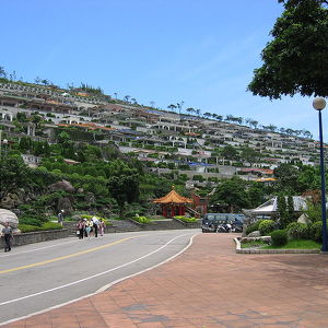
Chin Pao San
Chin Pao San is a private cemetery located on a mountainside in Jinshan District, New Taipei, Taiwan. The site overlooks the Ju Ming Museum and, beyond it, the East China Sea. Urns at Jinbaoshan are placed both indoors and outdoors. The site is acce...
Houtong Cat Village
Houtong was once a rich small mining town in Ruifang, renowned for a well-preserved culture surrounding its railway, which was built during the Japanese rule of Taiwan. During its prosperous years, the area produced around 220,000 tons of coal per year...
Counter
30
TOP DESTINATIONS

4655
PLACES OF INTEREST

13698
HOTELS

26619
CAFES AND RESTAURANTS
Contact us
You can get in touch with us by filling out this form