
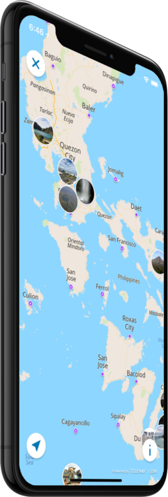

Offline map
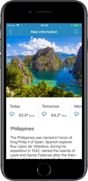
Philippines
Travel with a high-quality offline map featuring the most interesting sites, available on iPhone!
Country Days Tracker - this app track the days you spend in different countries helping you with visas and tax residency. Try it now!
Features
Turn your trip into an exciting and unforgettable experience
with the Philippines offline mobile map!
TOP DESTINATIONS
Our offline map offers you information about 63 top destinations, featuring high-quality descriptions, photos, and reviews written by real travelers.
HIGH-QUALITY CONTENT
Every location we feature comes with a description, a photo, and reviews written by real people.
SAVE ON MOBILE DATA!
All of the app’s features work offline! Simply download our completely autonomous map before your trip, and save mobile traffic!
FIND TOP DESTINATIONS NEARBY!
In addition to our featured locations, you will find tens of thousands of other useful places in our guide (hotels, restaurants, teller machines, public transport stops, points of interest, etc.)
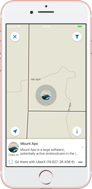
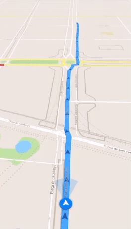
OFFLINE NAVIGATION
Plan the best driving, walking, or biking route offline! Save your locations, so you can always easily find your way back and never get lost.
WEATHER FORECAST AND CURRENCY CONVERSION!
Latest weather forecast and a handy conversion rate calculator for 200+ different currencies!
Top places of interest
Here is a list of just a few of the places of interest that you can find on our offline map.
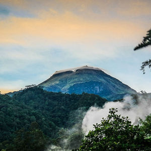
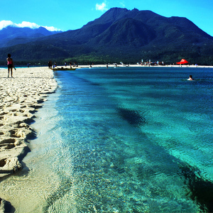
Mount Apo
Mount Apo is a large solfataric, potentially active stratovolcano in the island of Mindanao, Philippines. With an elevation of 2,954 metres (9,692 ft) above sea level, it is the highest mountain in the Philippine Archipelago and is located between Dava...
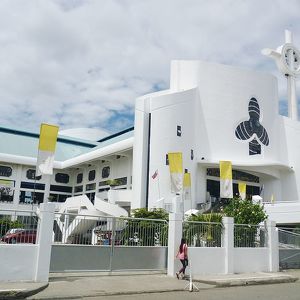
Zamboanga Cathedral
The first church was originally located at the front of Plaza Pershing, where the present Universidad de Zamboanga stands. The church was designated a cathedral in 1910 when the diocese of Zamboanga was created. In 1943, the cathedral was one of the ed...
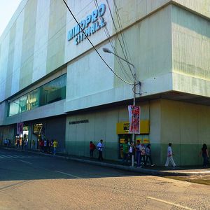
SM Mindpro Citimall
SM Mindpro Citimall is a shopping mall in Zamboanga City, as well as the 4th largest shopping mall in Zamboanga Peninsula, Philippines located at La Purisima St., Zamboanga City. The mall houses Mindpro Supermarket, 3 cinemas, a foodcourt and Departmen...
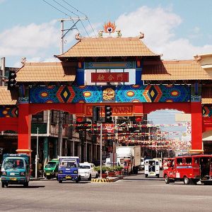
Davao Chinatown
The Davao Chinatown is the Chinatown of the city of Davao and the only one in Mindanao. It is the primary residential area of the Chinese Philippine community in the city. The area is bordered by Santa Ana Avenue, Monteverde Avenue, Ramón Magsaysay Str...
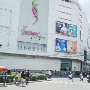
Southway Square
Southway Square
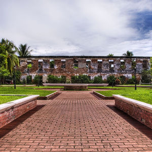
Fort Pilar
The Real Fuerza de Nuestra Señora del Pilar de Zaragoza, also Fort Pilar, is a 17th-century military defense fortress built by the Spanish colonial government in Zamboanga City, Philippines. The fort, which is now a regional museum of the National Muse...
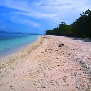
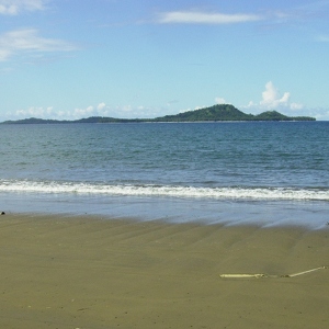
Great Santa Cruz Island
Great Santa Cruz Island is a small inhabited island in Zamboanga City in the southern region of the Philippines that is famous for its pink coralline sand. The island, located 4 kilometres (2.49 mi) south of downtown at the Santa Cruz Bank in the Basil...
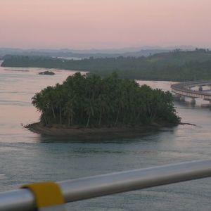
San Juanico Strait
San Juanico Strait is a narrow strait in the Eastern Visayan region in the Philippines. It separates the islands of Samar and Leyte and connects the Carigara Bay (Samar Sea) with the San Pedro Bay (Leyte Gulf). It is about 38 kilometres (24 mi) long. A...
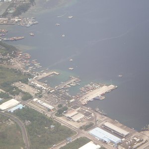
Sarangani Bay
Sarangani Bay is a bay located on the southern tip of Mindanao in the Philippines. It opens up to the Celebes Sea on the Pacific Ocean. General Santos City, one of the Philippines most important cities and ports, is located at the head of the bay, maki...
Camiguin
Camiguin is an island province in the Philippines located in the Bohol Sea, about 10 kilometres (6.2 mi) off the northern coast of Mindanao. It is politically part of the Northern Mindanao Region of the country and formerly a part of Misamis Oriental p...
Leyte Gulf
Leyte Gulf is a gulf in the Eastern Visayan region in the Philippines. The bay is part of the Philippine Sea of the Pacific Ocean, and is bounded by two islands; Samar in the north and Leyte in the west. On the south of the bay is Mindanao Island, sepa...
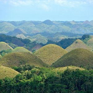
Chocolate Hills
The Chocolate Hills are a geological formation in the Bohol province of the Philippines. There are at least 1,260 hills but there may be as many as 1,776 hills spread over an area of more than 50 square kilometres (20 sq mi). They are covered in green ...
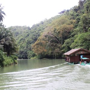
Loboc River
The Loboc River is a river in the Bohol province of the Philippines. It is one of the major tourist destinations of Bohol. The source of the Loboc River is located in the town of Carmen, almost in the center of Bohol. From Carmen, the river takes a ...
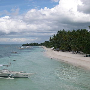
Alona Beach
The Alona Beach is located on the Panglao island, Philippines. It is situated around 20 kilometres (12 mi) from Tagbilaran. It is one of the most famous tourist spots in the Bohol province, because of its white sand and the rocky cliffs surrounding ...
Sulu Archipelago
The Sulu Archipelago is a chain of islands in the Pacific Ocean, in the southwestern Philippines. The archipelago forms the northern limit of the Celebes Sea and southern limit of the Sulu Sea. The Sulu Archipelago islands are within the Mindanao islan...
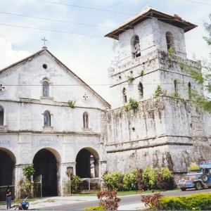
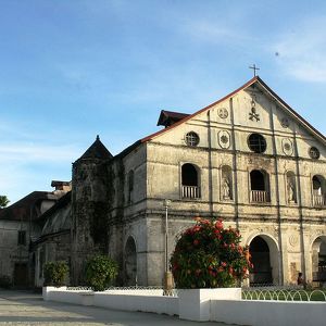
Baclayon Church
La Purisima Concepcion de la Virgen Maria Parish Church, commonly known as Baclayon Church, is a Roman Catholic Church in the municipality of Baclayon, Bohol, Philippines within the jurisdiction of the Roman Catholic Diocese of Tagbilaran. Baclayon was...
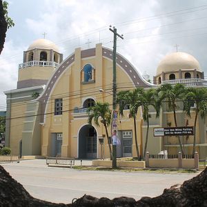
Loboc Church
The San Pedro Apostol Parish Church, commonly known as Loboc Church, is a Roman Catholic church in the municipality of Loboc, Bohol, Philippines, within the jurisdiction of the Roman Catholic Diocese of Tagbilaran. After the Jesuits established the ...
Church of Jagna
Church of Jagna
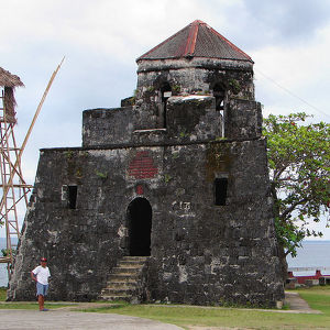
Punta Cruz Watchtower
The Fort of Saint Vincent Ferrer or commonly known as Punta Cruz Watchtower (Bantayan ng Punta Cruz) is a Spanish colonial era watchtower located at the western tip of the municipality of Maribojoc, Bohol, Philippines. Also known as Maribojoc Watchtowe...
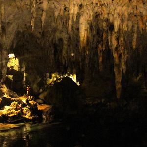
Hinagdanan Cave
Hinagdanan Cave is a cave in the municipality of Dauis on Panglao Island, in Bohol Province, in the Philippines. It is a naturally lighted cavern with a deep lagoon and many large stalactites and stalagmites. The cave is lit by sunlight which filter...
Counter
63
TOP DESTINATIONS

5132
PLACES OF INTEREST

15352
HOTELS

21292
CAFES AND RESTAURANTS
Contact us
You can get in touch with us by filling out this form