
Offline map
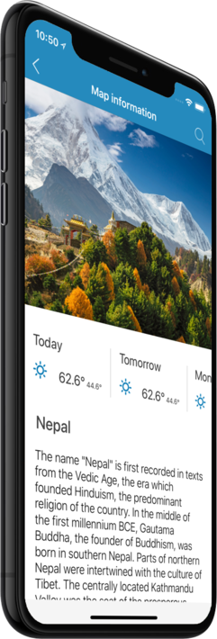
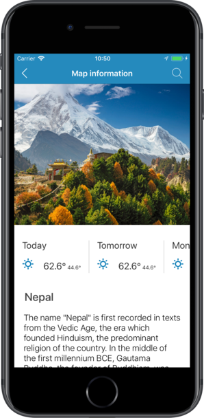
Nepal
Travel with a high-quality offline map featuring the most interesting sites, available on iPhone!
Country Days Tracker - this app track the days you spend in different countries helping you with visas and tax residency. Try it now!
Features
Turn your trip into an exciting and unforgettable experience
with the Nepal offline mobile map!
TOP DESTINATIONS
Our offline map offers you information about 52 top destinations, featuring high-quality descriptions, photos, and reviews written by real travelers.
HIGH-QUALITY CONTENT
Every location we feature comes with a description, a photo, and reviews written by real people.
SAVE ON MOBILE DATA!
All of the app’s features work offline! Simply download our completely autonomous map before your trip, and save mobile traffic!
FIND TOP DESTINATIONS NEARBY!
In addition to our featured locations, you will find tens of thousands of other useful places in our guide (hotels, restaurants, teller machines, public transport stops, points of interest, etc.)
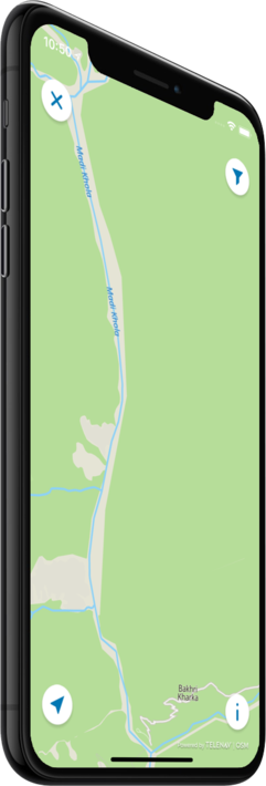
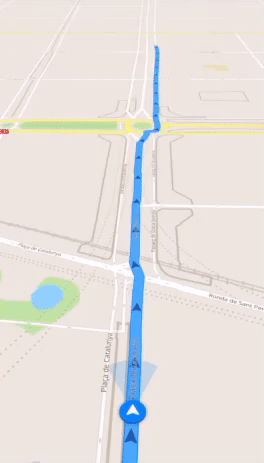
OFFLINE NAVIGATION
Plan the best driving, walking, or biking route offline! Save your locations, so you can always easily find your way back and never get lost.
WEATHER FORECAST AND CURRENCY CONVERSION!
Latest weather forecast and a handy conversion rate calculator for 200+ different currencies!
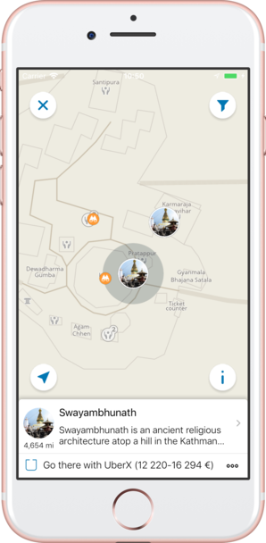
Top places of interest
Here is a list of just a few of the places of interest that you can find on our offline map.
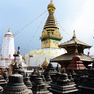
Swayambhunath
Swayambhunath is an ancient religious architecture atop a hill in the Kathmandu Valley, west of Kathmandu city. The Tibetan name for the site means 'Sublime Trees' (Wylie: Phags.pa Shing.kun), for the many varieties of trees found on the hill. However,...
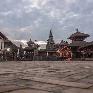
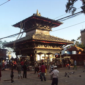
Bhaktapur
Bhaktapur has the best-preserved palace courtyards and old city center in Nepal and is listed as a World Heritage Site by UNESCO for its rich culture, temples, and wood, metal and stone artworks. This is supported by the restoration and preservation ef...
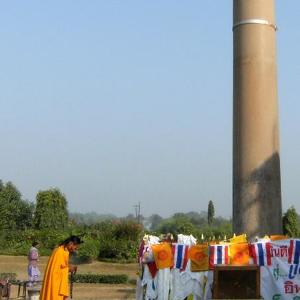
Lumbini
Lumbinī is a Buddhist pilgrimage site in the Rupandehi District of Province No. 5 in Nepal. It is the place where, according to Buddhist tradition, Queen Mayadevi gave birth to Siddhartha Gautama in 563 BCE. Gautama, who achieved Enlightenment some tim...
Sagarmatha National Park
The Sagarmatha National Park was established in 1976. In 1979, it became the country's first national park that was inscribed as a Natural World Heritage Site. In January 2002, a Buffer Zone comprising 275 km2 (106 sq mi) was added. Under the Buffer Zo...
Chitwan National Park
Since the end of the 19th century Chitwan – Heart of the Jungle – used to be a favorite hunting ground for Nepal’s ruling class during the cool winter seasons. Until the 1950s, the journey from Kathmandu to Nepal’s south was arduous as the area could o...
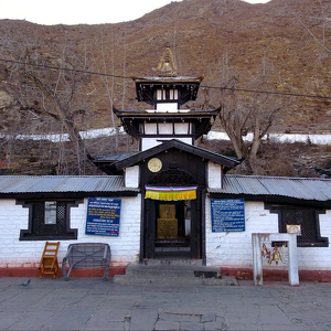
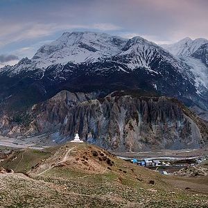
Muktinath
Within Hinduism, it is called Mukti Kshetra, which literally means the "place of liberation or moksh". This temple is considered to be 106th among the available 108 Divya Desam (premium temples) considered sacred by the Sri Vaishnava sect. The ancient ...
Lo Manthang
More prosaically, Lo Manthang is a Village Development Committee in Mustang District, Dhawalagiri Zone of northern Nepal. The 1991 Nepal census counted 876 people living in 178 households. The population includes ethnic Lhobas. Lo is the culturally ...
Tansen
Tansen was the capital of the Magar kingdom Tanahun, one of the most powerful regional principalities before the rise of the Shah dynasty. It even came close to conquering Kathmandu in the 16th century under the leadership of Mukunda Sen. Local Magar k...
Manakamana
The Manakamana temple lies 12 km south of the town Gorkha.The temple is located on a distinguished ridge 1,302 metres (4,272 ft) above sea level and overlooks the river valleys of Trisuli in the south and Marsyangdi in the west. The Manaslu- Himachali ...
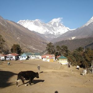
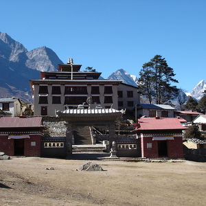
Tengboche Monastery
Tengboche monastery is amidst the Sagarmatha National Park, draped with a panoramic view of the Himalayan Mountains, including the well-known peaks of Tawache, Everest, Nuptse, Lhotse, Ama Dablam, and Thamserku. Tengboche is the terminus site of the...
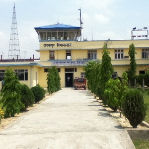
Janakpur Airport
The airport resides at an elevation of 256 feet (78 m) above mean sea level. It has one runway designated 09/27 with an asphalt surface measuring 1,300 by 30 metres (4,265 ft × 98 ft). The airport is capable to handle aircraft from the Nepalese Army...
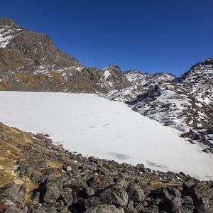
Gosaikunda
The Gosaikunda area has been delineated as a religious site. Hindu mythology attributes Gosaikunda as the abode of the Hindu deities Shiva and Gauri. The Hindu scriptures Bhagavata Purana, Vishnu Purana and the epics Ramayana and Mahabharata refer to S...
Annapurna Circuit
The trek usually takes about 15–20 days, leaving from Kathmandu with a stopover in Pokhara before returning to the capital. The trail is moderate to fairly challenging and makes numerous river crossings over steel and wooden suspension bridges. Tea hou...
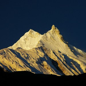
Mansiri Himal
Mansiri Himal is a small, high subrange of the Himalaya in north-central Nepal, about 100 km northwest of Kathmandu. The Marsyangdi River separates the Mansiri from the Annapurnas to the southwest, then an upper tributary Dudh Khola separates Peri Hima...
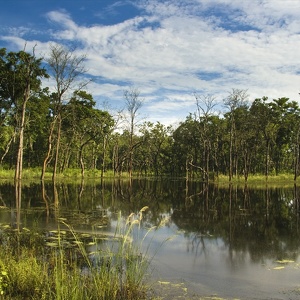
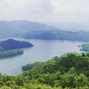
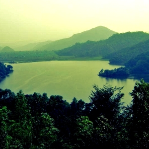
Begnas Lake
Begnas Lake area with a number of resorts is a popular destination for tourists visiting Pokhara. The water from the lake is used for irrigation and some parts of the lake are used as caged fisheries. The Begnas lake area has a number of swampy areas a...
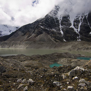
Imja Tsho
Imja Tsho has been identified as one of the potentially dangerous lakes in Himalaya. It is located at 27° 53' 55" N latitude, 86° 55' 20" E longitude and at an altitude of 5010 m in Everest region of Nepal. The catchment of Imja Tsho occupies the north...
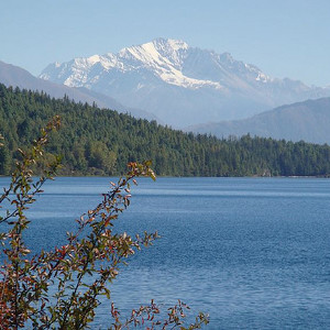
Phewa Lake
Phewa lake and water sports is the main tourist attraction of Pokhara city and the north shore of the lake has developed into a tourist district, commonly called Lake-Side, with hotels, restaurants and bars catering to the tourists. The water from Phew...
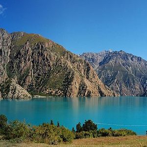
Phoksundo Lake
There are more than 20 stupas in the southern belt, and one gompa in the eastern side of the lake, where annual prayers and worship are carried out. Traditional Tibetan culture prevails in upper Dolpo; Buddhism and Bon are prevalent in lower Dolpo, inc...
Rara Lake
Rara Lake lies at an altitude of 2,990 m (9,810 ft) above sea level, has a water surface of 10.8 km2 (4.2 sq mi), a maximum depth of 167 m (548 ft), is 5.1 km (3.2 mi) long and 2.7 km (1.7 mi) wide. It drains into the Mugu Karnali River via the Nijar R...
Rupa Lake
Rupa lake is the one of main tourism attraction among Begnas Lake of the Pokhara city. It provides enough space for boating experiences for national and international visitors. Cage culture as well as pen culture have been practiced in Rupa lake for fi...
Counter
52
TOP DESTINATIONS

804
PLACES OF INTEREST

2839
HOTELS

3415
CAFES AND RESTAURANTS
Contact us
You can get in touch with us by filling out this form